There will be some fairly major detours on the Gardiners Creek Trail due to the widening of the tollway coming up in the next few months. Also a few changes:
Apparently they have decided not to replace the York Rd footbridge due to the cost. As a sweetener to the locals—they were the only ones notified—it has been suggested that some of the nearby paths could be upgraded. Here's the planners map, their new sections of path are shown in blue. I have added the Gardiners Creek Trail in mauve for reference:
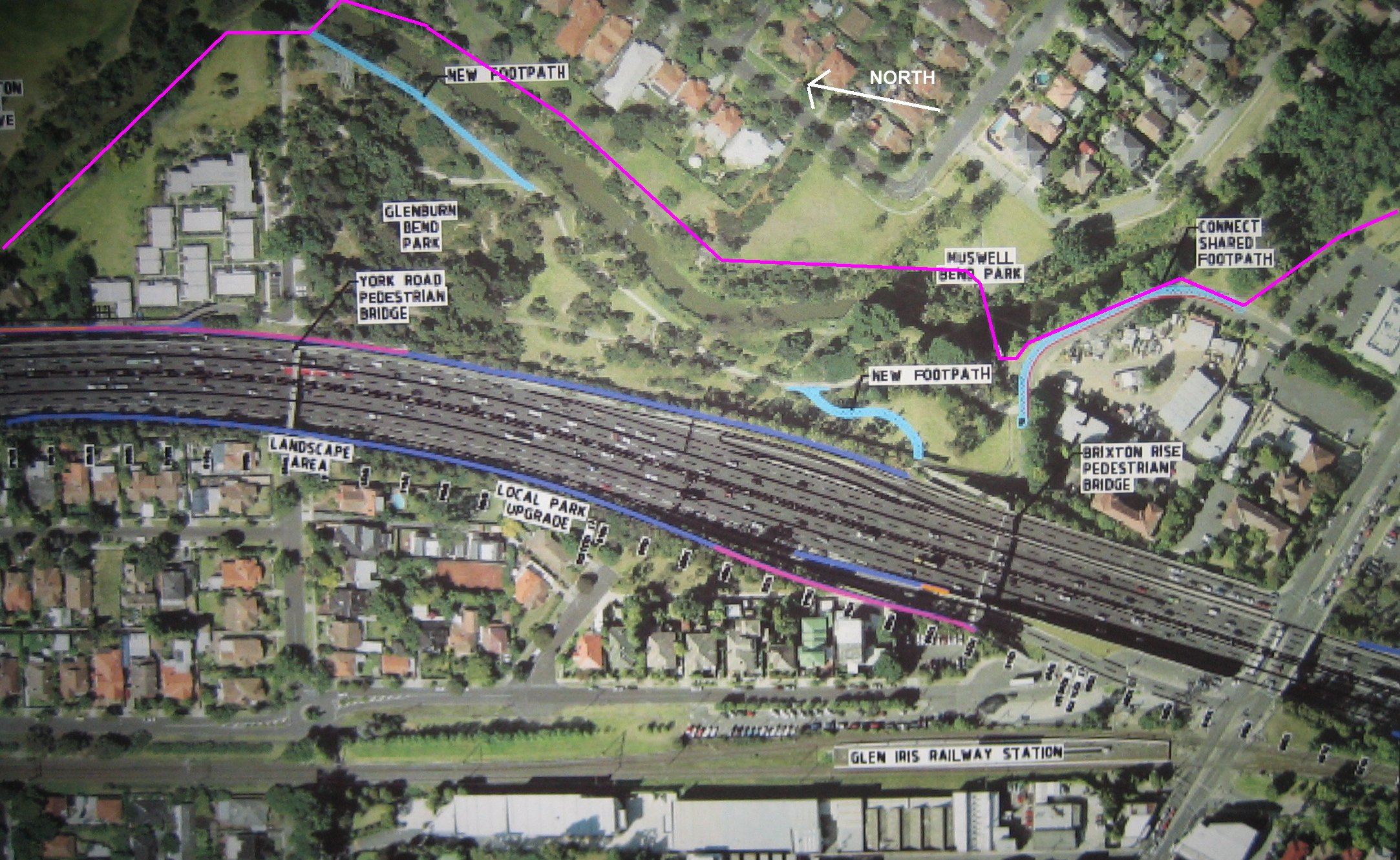
As you can see the new paths do nothing for the Gardiners Creek Trail except at Brixton Rise, the small road section by the council depot. The road will remain but just be narrowed. It was also suggested the paths may just use crushed granite for their surface. In summary there's nothing sweet for cyclists in this deal. Once again Stonnington has done little for cyclists.
It is clear cyclists are not being considered in general. The people I spoke with were not aware of the VicRoads cyclist counter nearby, that registers 120 cyclist per hour during peak hrs and 600 to 700 per day for weekdays. Nor were they aware of the location of all the nearby trails and had never heard of the Gardiners Creek gap. To be fair, they welcomed feedback on any of these matters—and they will be getting some from us.
As I understand it the Malvern Valley Golf course is going to receive quite a lot. In particular the tollway runoff water will be used to water the golf course. Nothing wrong with that as they currently pump it out of the creek. However, how about a few more path reworks:
-
The new section of path (roughly between Estella St and Saxby Rd) just replaced by Boroondara council could have been located on the Stonnington side eliminating the need to cross two bridges. Unlikely to ever happen now.
-
On the south side of High St the path loops up from the bridge steeply and then descends back down again further on by the Gazebo. How about flattening this section out? This would certainly still be a possibility.
-
The section at Winton Rd, which is about to be upgraded by Boroondara council, could probably be on the golf course. Once again eliminating two bridge crossings. Unlikely to ever happen.
-
The big one - the Gardiners Creek Gap. The tollway builders are expected to improve the local amenity in return for the amenity lost (land lost to the widened tollway). Councils typically do the deals, to get their projects built (e.g. the golf course watering system).
It appears that in widening the freeway it would be possible to run a path from the existing East Malvern footbridge on the north side (golf course side) and run it parallel to the tollway up to the road that enters the golf course (Golfers Drive). It's an easy link from there through to Thurso St.
Note for reasons I don't understand the East Malvern Station footbridge is to be "straightened". I suspect this is to allow the green to be extended on the adjacent fairway - east side of bridge. See the map here for routes at Gardiners Creek.
By contrast, Boroondara council rather than going for a few metres of path are plugging for a whole new bridge at Glenferrie Rd, whether that will occur nobody knows. In addition new parts of path are being built out of their own budget on the Gardiners Creek Trail. Plus it's in the process of auditing the Yarra Trail and Koonung Creek Trail. Stonnington whacks in a few solar powered LED lights and become instant heroes and win an award. Just colour and movement.
If you are interested, the next and last public info session will be at:
Monday April 28
Malvern Town Hall (Banquet Room)
Cnr Glenferrie Road and High Street Malvern.
More info: M1 Upgrade Project Community Information Sessions
P.S. Information I have supplied may not be totally accurate.