Apparently, last weekend's flood was something you'd see "once in 500 years". While absolutely nothing compared to recent flooding elsewhere in this country, it was a big one for this little suburban creek.
On Tuesday, just on a whim, I rode to work on the Gardiners Creek Trail rather than my usual on-road route. And I must say, there was some impressive destruction. Kudos to Boroondara and Stonnington councils, workers from both sides of the creek were out in force clearing up, repairing damaged paths and top-dressing the playing fields.
Anyway, here's a sample of what I saw.
High water line
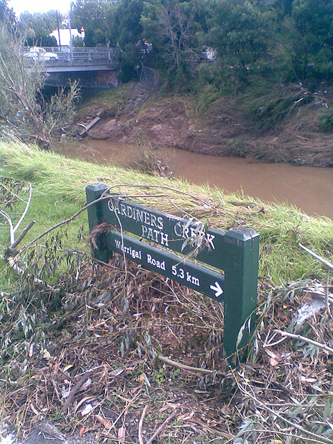 In the background, the creek has receded but is still well above normal levels. The debris and high water line shows that the water nearly reached road level at this point.
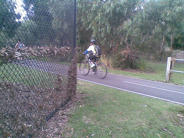 The high water mark, as shown by the debris stuck in the fence at shoulder height, indicates that the water really was up. You can't see the creek from this point because it's behind the trees in the background.
Dominoes
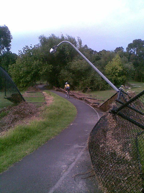 This high fence in the Malvern Valley Golf Links, which is two fairways away from the creek, toppled like a row of dominoes.
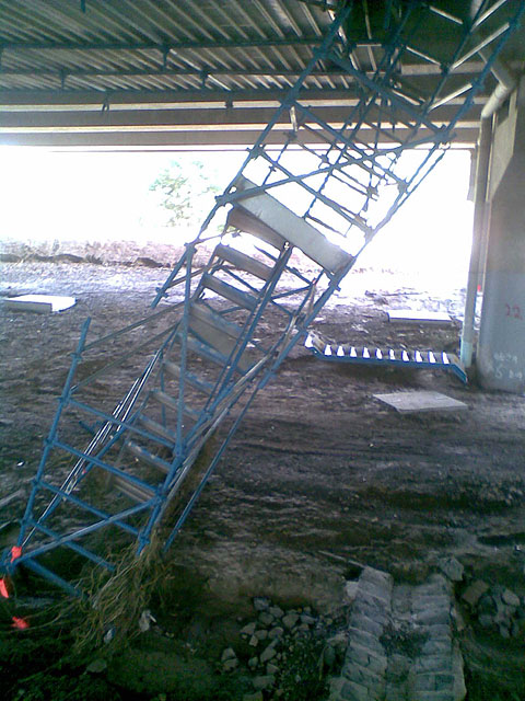 Under the freeway, all the scaffolding for the M1 Project had got a little tilted too.
Judging by the debris left on railings in this area, the water level under Glenferrie Road would have been well above head height.
Deposits
Sand, silt, mud and debris were deposited all along the creek.
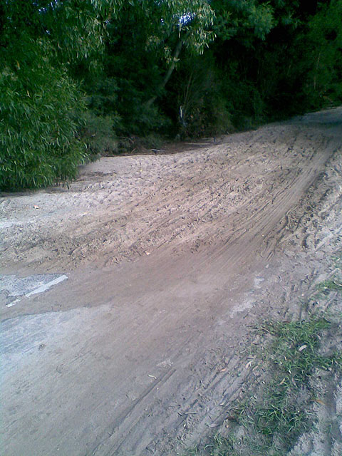 This children's sandpit is actually a 2.5m wide sealed path.
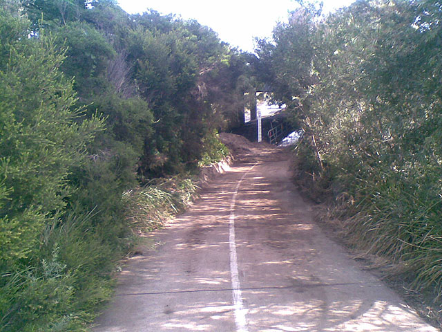 The underpass at Toorak Road was closed and workers were already clearing away the sediment. Note the pile of silt already removed from the path.
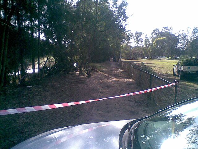 Not strictly Gardiners Creek Trail, here Stonnington Council workers clear up the path through Kooyong Park. Note the small tree stump to the left of the path…
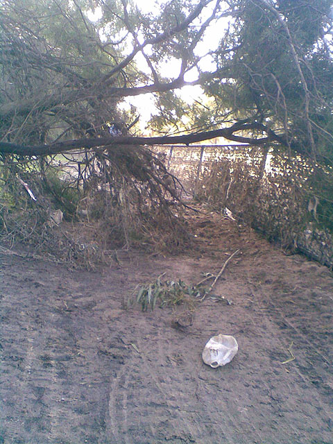 …this tree was attached to that stump the day before. It took a bit of getting past.
Water, water, everywhere
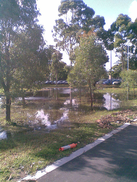 Patterson Reserve had acquired a new ornamental lake—which was already starting to stink a bit.
I don't have a photo of the grounds at St Kevin's College but it too was turned into a lake (and later a stinky swamp) by the surge of water. Interestingly, the grounds of both St Kev's and Scotch College are protected by levees. Scotch's slightly high levee appears to have held, St Kev's lower one clearly did not.
Gone
But, of course, I've left the best until last:
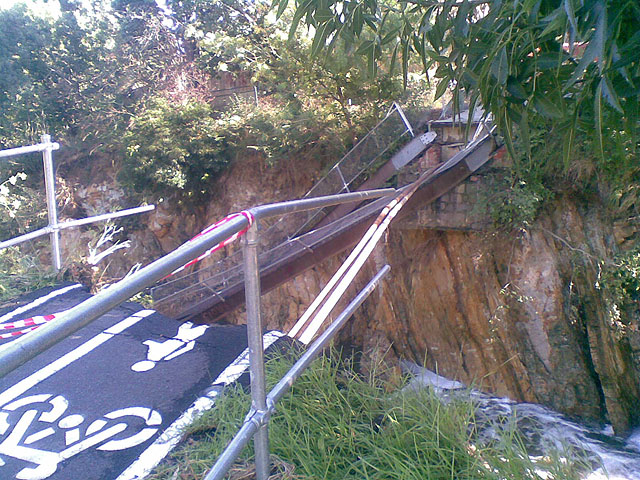 This tangled mess is the Solway Street Bridge…
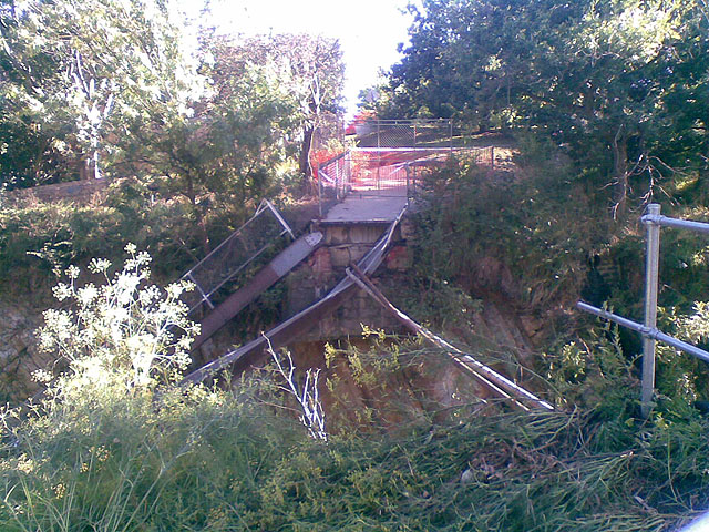 …or what's left of it.
(Much more impressive photos on Melbourne Cyclist.)
Yes, this is the same Solway Street Bridge that was closed for about 18 months awaiting replacement before the two local councils decided that a patch-up job would be adequate. (At this point, I'd like to highlight what I said in May 2007. Aren't I the smug one?)
What now?
According to a small note in a presentation made last year:
Solway Street Bridge
A new bridge will be constructed in 2011/12 FY to improve the width and alignment of the existing bridge. This is part of the larger project to build the missing link in the Gardiners Creek Trail between Solway Street and Warrigal Road.
I think we can safely assume that this work will be brought forward to the 2010/11 FY—surely local residents couldn't be kept waiting another 18 months to have access returned here? I certainly support Zed's recommendation to contact the council (I'd say both councils and Melbourne Water) requesting the immediate replacement of this bridge.
Incidentally, I wonder if pitt & sherry will be invited to tender on the new bridge?
In any case the new bridge had better be pretty flood tolerant, it looks like Melbourne suburbs are likely to flood more often…
Comments
Wheee! I've stood on that bridge during one of the really big storms when the creek was all white-water, but these photos are really another order of magnitude more.
I have some photos of Scotchman's creek, one of Gardiner's feed creeks. Basically the flood reserve from Blackburn rd completely underwater.